Case Study | Google Earth Enterprise
Taiwan GIS Center employs Google Earth Enterprise to improve emergency preparedness and land planning Background Taiwan Geographic Information System Center (TGIC) assists the government in promoting geotechnology applications, as well as related private sector development. It is considered to be the country’s premiere geographic information system “think tank”. At a Glance What they wanted to do • �Improve communications and information sharing with citizens during disasters • �Enhance disaster response preparedness and land planning • �Establish the NGIS as a robust platform for spatial data and other land information • �Ensure a robust and scalable solution for a growing community of users and programmers What they did • �Implemented Google Earth Enterprise to visually communicate critical spatial and environmental information What they achieved • �Higher usage of the NGIS by users and programmers due to familiarity with the interface • �Improved contingency planning and disaster response • �Increased public participation and speed of disaster response mobilisation
TGIC acts as a professional advisor to the Council of Economic Planning and Development (CEPD) and assists with the promotion and development of the National Geographic Information System (NGIS) – Taiwan’s system of geographic information that serves as a comprehensive repository of the geospatial data for all of its provinces. The data is used to document natural landscape – terrain, mountains, and rivers; and human environment – land use, village distribution and administrative boundaries. Being able to capture events happening in real time such as landslides and earthquakes in the system is critical as it helps government, NGOs and communities improve planning for future disaster response. Challenges The NGIS stores vast amounts of geographical data and TGIC needed a robust and customisable mapping solution that would integrate with its existing legacy systems. Additionally, traditional geographic information system (GIS) interfaces were complex in nature. Composed of 2D maps and symbols, they were difficult to understand and were expensive. TGIC sought a more sophisticated presentation of spatial information with an interface that users would be familiar with and could easily comprehend. Vice General Manager of TGIC, Lee Wankai says, “Taiwan experiences frequent natural disasters and while the occurrence of natural disasters is hard to predict, the extent of resulting damages can be lessened. We sought a well-designed visualisation and interactive tool for disaster response and one that would encourage public participation.”
“We were looking for the best solution that could support a large number of users accessing the GIC data, excellent user-interface and good APIs that allowed our programmers to create their own programs. Google Earth and Maps was one of our solutions.” —Lee Wankai, General Manager of TGIC
Solution TGIC chose Google because it is familiar to online users and with programmers. They also saw that Google provides powerful tools that would help improve land planning and contingency planning for natural disasters.
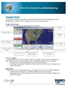
About Google Earth Enterprise
Google Earth Enterprise allows you to store and process terabytes of imagery, terrain and vector data on your own server infrastructure, and publish maps securely for your users to view using Google Earth desktop or mobile apps, or through your own application using the Google Maps API. For more information, visit www.google.com/enterprise/mapsearth “�Google street views are the most real life representations of the space used in people’s lives. This familiarity has empowered citizens to contribute critical information to create richer content to help improved disaster response times and resource mobilisation.“ —Lee Wankai, General Manager of TGIC
Lee says, “We chose Google because it offered 3D graphic perspectives. Traditional GIS software only offered 2D perspectives which was insufficient as we needed to determine the height of buildings and natural landscapes. We now have the option to alternate between 2D and 3D perspectives in maps for more accurate planning.” They also needed to ensure that the cost to performance ratio was competitive. Lee says, “As we have to work with several legacy systems and vast amounts of government data, it was paramount that the chosen solution be reliable, secure and highly customisable.” He adds, “Google Earth Enterprise proved to be the most developer-friendly solution in the market. As users are more familiar with the interface, they are more inclined to apply them for industry use.” Results Information from across nine major spatial databases and six application groups are currently being integrated into one platform and is now available on the public website http://ngis.nat.gov.tw/. Information such as addresses, traffic routes, tourism data, geological attributes, conduits, pipelines, land prices and water resources can now be read, processed, analysed and integrated into a single map. From a solution’s performance standpoint, TGIC saw increased efficiency during map programming. Programmers are familiar with Google’s API and the development process is much faster compared to the traditional GIS interface. Additionally, Google helped TGIC support high-volume web mapping applications, and manage high traffic and spikes in demand. The Taiwan government will be able to reach out to more people in a shorter period of time during disasters and provide information to help them make better choices. For example, during landslides and floods, online users can use Google to help them identify which roads have been cut-off and view alternative routes. With Google’s 3D view, users can assess the severity of the situation and be compelled to respond faster. From the government’s point of view, this functionality offers added benefits in that it allows civil defence and disaster response teams to determine the best disaster response and evacuation plans. To date, there are over 40,000 users of the NGIS and TGIC expects this number to increase by 10,000 users each year as the perceived value of GIS information grows stronger. They predict that in the future, more organisations from the private sector will use this information for other purposes, such as tourism and construction projects.
© 2013 Google Inc. All rights reserved. Google and the Google logo are trademarks of Google Inc. All other company and product names may be trademarks of the respective companies with which they are associated. SS2097-1305